
1. Metadata
IRI |
|
Preferred Label |
Cadastre Model |
Definition |
A Semantic Web data model of cadastre information. It caters specifically for Queensland’s data management needs. |
Created |
2023-05-11 |
Modified |
2023-06-07 |
Issued |
0000-00-00 - not formally issued yet |
Creator |
|
Publisher |
|
Provenance |
This model was made for Queensland Spatial Information, a unit of the Queensland Department of Resources, to assist with their future address and roads database design. It is a Component Model of their 'QSI Supermodel' which includes models for Address, Geographical Names and Cadastral information which are all designed to work together, however they may all be used independently too. |
Status |
Beta version |
Version |
|
Code Repository |
|
License |
|
Copyright |
© The State of Queensland (Department of Resources) 2020-2023 |
Machine-readable form (RDF) |
2. Preamble
2.1. Abstract
A Semantic Web data model of cadastre information. It caters specifically for Queensland’s data management needs.
|
Note
|
This model was made for Queensland Spatial Information, a unit of the Queensland Department of Resources, to assist with their future address and roads database design. It is a Component Model of their 'QSI Supermodel' which includes models for Address, Geographical Names and Cadastral information which are all designed to work together, however they may all be used independently too. |
2.2. Namespaces
This model is built on a small set of well-regarded Semantic Web models which use a variety of namespaces. Prefixes for this namespaces, used throughout this document, are listed below.
| Prefix | Namespace | Description |
|---|---|---|
|
Namespace for this model |
|
|
Namespace for the Cadastral Interests vocabulary |
|
|
Dublin Core Terms namespace |
|
|
Generic examples namespace |
|
|
OGC GeoSPARQL model namespace |
|
|
Web Ontology Language ontology namespace |
|
|
RDF Schema ontology namespace |
|
|
Simple Knowledge Organization System (SKOS) ontology namespace |
|
|
Time Ontology in OWL namespace |
|
|
Vocabulary of Interlinked Data (VoID) ontology namespace |
|
|
XML Schema Definitions ontology namespace |
2.3. Conformance
This model conforms to the OntPub Profile which is a specification for ontology publication that mandates certain structural and metadata properties for the model as a whole and model elements. Metadata elements for the model as a whole - the ontology - are given in the Metadata section above.
3. Introduction
This model presents only a very basic class hierarchy for cadastral objects, Parcels and Parcel Aggregates, both of which it inherits from the ICSM Conceptual Model for 3D Cadastral Survey Dataset Submissions (CSDM) [CSDM]. That model, in turn, inherits basic spatial object classes and their relationships from [GEO]: Features, Feature Collections and Geometries, all of which are specialised forms of Spatial Object.
3.1. Major Modelling Principles
Major modelling principles present in this model are:
-
Overlapping and non-overlapping Parcels
-
3D Parcels
-
Parcel Aggregates and Properties
3.1.1. Overlapping and non-overlapping Parcels
All the area of the State of Queensland is, in theory, covered by a single layer of contiguous, non-overlapping, parcels which are called Base Parcels and of which there are various types:
-
Lot, Road, Water and the edge case Interstate
These parcels MAY NOT have an overlaps relationship, declared or calculated, that indicates another Base Parcel.
All types of Non-Base Parcel, MUST overlap one or more Base Parcel. The subtypes of Non-Base Parcel are:
-
Building, Easement and Interest
3.1.2. 3D Parcels
Being described in 3-dimensions is a possible attribute of any type of Parcel, thus there is no 3D or Volumetric parcel directly.
3.1.3. Parcel Aggregates and Properties
Parcel Aggregates are special kinds of Feature Collections whose spatial projection - their Geometry - is the union of the Parcels that are members of collection.
Property is a special kind of Parcel Aggregate, some forms of which may be required to have their constituent Parcels touching one another. Other types may not have this restriction.
3.2. Sources of Requirements
This model was initially built to represent the various types of cadastral parcel proposed for use in Queensland’s updated cadastral maintenance environment as designed in 2022-2023.
Overarching objects for this model are to:
-
be a system-independent (conceptual/logical) expression of Queensland’s cadastral data model
-
allow for the integration of cadastral information with feature labelling information, such as addressing, feature naming and road naming
-
act as a candidate (inter)national cadastral data model for Australia & New Zealand, should ANZ move to a harmonised model
-
allow for interoperability with other major spatial data initiatives in Australia, in particular the FSDF Supermodel [FSDFSM].
Detailed requirements for this model all stem from these top-level requirements. The individual requirements are listed in the Requirements section.
3.3. Model resources
This document is this model’s "Specification" which is its authoritative, human-readable, definition document. This model also contains other resources with other roles:
| Resource | Role | Notes |
|---|---|---|
Schema |
The technical, machine-readable, version of this model |
|
Vocabulary |
The codelist vocabularies developed for this model and links to others defined elsewhere but used by this model |
|
Requirements Section |
Guidance |
The Requirements addressed by this model |
Validation Section & SHACL Validator |
Validation |
The machine-readable validator file used to validate data claiming conformance to this model |
Examples Section & Extended example data files |
Example |
Examples of data conforming, and some not conforming, to this model |
Code Repository |
The online, version control, repository containing all the resources of this model |
Data made according to this model, when stored in one of the RDF [RDF] serialization formats such as Turtle [TTL], is directly validatable according to this model through use of validators that are supplied, see Section Validation.
4. Model
This model is composed of Web Ontology Language (OWL) [OWL] Classes and Properties. While some properties may be restricted in their use to various classes, the Classes and Properties are actually defined individually and both are "first class model citizens", with global identity, that can be used in isolation and together. This is in contrast to Unified Modelling Language (UML) Class Diagrams which treat Properties as sub-parts of particular classes.
This model defines some Classes and Properties and also requires certain existing Cs & Ps for reuse. All Cs & Ps in this model, both defined and reused, are listed here with an indication of where the element is defined given in the Is Defined By field.
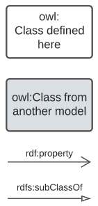
4.1. Classes
The Classes within this model form a single Class Hierarchy with Spatial Object as the root class. The top-level classes of Spatial Object, Feature, Feature Collection and Geometry are all inherited from [GEO] and used here unchanged.
4.1.1. Spatial Object
| Property | Value |
|---|---|
IRI |
|
Preferred Label |
Spatial Object |
Definition |
Anything spatial (being or having a shape, position or an extent) |
Is Defined By |
|
Scope Note |
This class is not expected to be instantiated directly through use of this model |
Example |
|
4.1.2. Feature
| Property | Value |
|---|---|
IRI |
|
Preferred Label |
Feature |
Definition |
A discrete spatial phenomenon in a universe of discourse |
Is Defined By |
|
Sub-class Of |
|
Scope Note |
This class is not expected to be instantiated directly through use of this model |
Example |
|
4.1.3. Parcel
| Property | Value |
|---|---|
IRI |
|
Preferred Label |
Parcel |
Definition |
A single or multi area, or solid, above, or below the surface of the earth as specified through legislated process. The extent of a cadastral parcel can be described by a surface or solid and topological relationships with other parcels |
Is Defined By |
This Model |
Sub-class Of |
|
Scope Note |
This class is not expected to be instantiated directly through use of this model, instead specialised forms of it (subclasses) are |
Example |
|
4.1.4. Base Parcel
| Property | Value |
|---|---|
IRI |
|
Preferred Label |
Base Parcel |
Definition |
A Parcel which may not overlap other instances of the same class |
Is Defined By |
This Model |
Sub-class Of |
|
Scope Note |
This class is not expected to be instantiated directly through use of this model, instead specialised forms of it (subclasses) are |
Example |
|
4.1.5. Lot Parcel
| Property | Value |
|---|---|
IRI |
|
Preferred Label |
Lot Parcel |
Definition |
|
Is Defined By |
This Model |
Sub-class Of |
|
Example |
|
4.1.6. Road Parcel
| Property | Value |
|---|---|
IRI |
|
Preferred Label |
Road Parcel |
Definition |
|
Is Defined By |
This Model |
Sub-class Of |
|
Example |
|
4.1.7. Intersection Parcel
| Property | Value |
|---|---|
IRI |
|
Preferred Label |
Intersection Parcel |
Definition |
|
Is Defined By |
This Model |
Sub-class Of |
|
Example |
|
4.1.8. Transport Route Parcel
| Property | Value |
|---|---|
IRI |
|
Preferred Label |
Transport Route Parcel |
Definition |
|
Is Defined By |
This Model |
Sub-class Of |
|
Example |
|
4.1.9. Water Parcel
| Property | Value |
|---|---|
IRI |
|
Preferred Label |
Water Parcel |
Definition |
|
Is Defined By |
This Model |
Sub-class Of |
|
Example |
|
4.1.10. Non-Base Parcel
| Property | Value |
|---|---|
IRI |
|
Preferred Label |
Non-Base Parcel |
Definition |
A Parcel that must overlap one or more instances of Base Parcel |
Is Defined By |
This Model |
Sub-class Of |
|
Expected Properties |
|
Scope Note |
This class is not expected to be instantiated directly through use of this model, instead specialised forms of it (subclasses) are |
Example |
|
4.1.11. Easement Parcel
| Property | Value |
|---|---|
IRI |
|
Preferred Label |
Easement Parcel |
Definition |
|
Is Defined By |
This Model |
Sub-class Of |
|
Example |
|
4.1.12. Interest Parcel
| Property | Value |
|---|---|
IRI |
|
Preferred Label |
Interest Parcel |
Definition |
|
Is Defined By |
This Model |
Sub-class Of |
|
Example |
|
4.1.13. Feature Collection
| Property | Value |
|---|---|
IRI |
|
Preferred Label |
Feature Collection |
Definition |
A collection of individual Features |
Is Defined By |
|
Sub-class Of |
|
Expected Properties |
|
Scope Note |
This class is not expected to be instantiated directly through use of this model |
Example |
|
4.1.14. Parcel Aggregate
| Property | Value |
|---|---|
IRI |
|
Preferred Label |
Parcel Aggregate |
Definition |
A parcel aggregate is a collection of parcels whose collective extent may be described as a spatial unit |
Is Defined By |
|
Sub-class Of |
|
Scope Note |
This class is not expected to be instantiated directly through use of this model |
Example |
|
4.1.15. Property
| Property | Value |
|---|---|
IRI |
|
Preferred Label |
Property |
Definition |
|
Is Defined By |
This Model |
Sub-class Of |
|
Scope Note |
This class is not expected to be instantiated directly through use of this model, instead specialised forms of it (subclasses) are |
Example |
|
4.1.16. Addressable Property
| Property | Value |
|---|---|
IRI |
|
Preferred Label |
Addressable Property |
Definition |
|
Is Defined By |
This Model |
Sub-class Of |
|
Example |
|
4.1.17. Rural Property
| Property | Value |
|---|---|
IRI |
|
Preferred Label |
Rural Property |
Definition |
|
Is Defined By |
This Model |
Sub-class Of |
|
Example |
|
4.1.18. Title Property
| Property | Value |
|---|---|
IRI |
|
Preferred Label |
Title Property |
Definition |
|
Is Defined By |
This Model |
Sub-class Of |
|
Example |
|
4.1.19. Valuation Property
| Property | Value |
|---|---|
IRI |
|
Preferred Label |
Valuation Property |
Definition |
|
Is Defined By |
This Model |
Sub-class Of |
|
Example |
|
4.1.20. Water Feature
| Property | Value |
|---|---|
IRI |
|
Preferred Label |
Water Feature |
Definition |
An aggregation of Water Parcels used to indicate the area of a water feature |
Is Defined By |
This Model |
Sub-class Of |
|
Example |
|
4.1.21. Road
| Property | Value |
|---|---|
IRI |
|
Preferred Label |
Road |
Definition |
An aggregation of Road Parcels, including Intersection and Transport Route Parcels, used to indicate the area of road |
Is Defined By |
This Model |
Sub-class Of |
|
Example |
|
4.2. Properties
4.2.1. member
| Property | Value |
|---|---|
IRI |
|
Preferred Label |
member |
Definition |
A member of the subject resource |
Is Defined By |
|
Example |
|
4.2.2. has geometry
| Property | Value |
|---|---|
IRI |
|
Preferred Label |
has geometry |
Definition |
A spatial representation for a given Feature |
Is Defined By |
|
Example |
|
4.2.3. overlaps
| Property | Value |
|---|---|
IRI |
|
Preferred Label |
overlaps |
Definition |
Simple Features [ISO19125-1] topological relation "overlaps" |
Is Defined By |
|
Example |
|
5. Supporting Vocabularies
This model depends on several vocabularies to give specific values to properties.
5.1. Cadastral Interests
This vocabulary is…
| IRI | Name | Description | Status | Usage directive |
|---|---|---|---|---|
|
X |
Xxx |
original |
Use |
This vocabulary is available in machine-readable form at https://linked.data.gov.au/def/cadint.
6. Requirements
Here are the itemised Requirements referenced in the Sources of Requirements subsection of the Introduction and note for them on how this model satisfies them.
6.1. Requirements List
| ID | Name | Description |
|---|---|---|
Req01 |
MUST be presented as a system-independent expression of Queensland’s cadastral data model |
This model must be presented at the conceptual/logical levels and not be dependent on a particular (physical) implementation |
Req02 |
MUST allow for the integration of cadastral information with feature labelling information, such as addressing, feature naming and road naming |
This model defines spatial object classes and names may be applied to objects in those classes. This model must provide classing and/or other properties that allow feature naming to be assigned to objects and for the assignment to be validatable |
Req03 |
MUST act as a candidate (inter)national cadastral data model for Australia & New Zealand, should ANZ move to a harmonised model |
This model must be generic enough, andor extensible enough, to be likely able to cater for other ANZ jurisdictions' parcel types |
Req04 |
MUST allow for interoperability with other major spatial data initiatives in Australia, in particular the FSDF Supermodel [FSDFSM] |
This model must show how it is conformant to other initiatives, in particular the [FSDFSM] |
7. Validation
This section will be completed when Business Rules for Road Labels are determined - etc. June, 2023
Bibliography
-
[CONNEGP] World Wide Web Consortium, Content Negotiation by Profile, W3C Working Draft (20 March 2022). https://w3c.github.io/dx-connegp/connegp/
-
[CSDM] Intergovernmental Committee on Surveying & Mapping (ICSM), ICSM Conceptual Model for 3D Cadastral Survey Dataset Submissions (CSDM), Semantic Web data model (2022). https://linked.data.gov.au/def/csdm
-
[FLM] The State of Queensland (Department of Resources). Feature Labelling Model. Semantic Web data model (2023). https://linked.data.gov.au/def/fl
-
[FSDFSM] Intergovernmental Committee on Surveying & Mapping (ICSM), FSDF Supermodel. Semantic Web data model (2022) https://linked.data.gov.au/def/fsdf-supermodel
-
[GEO] Open Geospatial Consortium, OGC GeoSPARQL - A Geographic Query Language for RDF Data, Version 1.1 (2021). OGC Implementation Specification. http://www.opengis.net/doc/IS/geosparql/1.1
-
[ISO-IEC-14977] International Organization for Standardization, ISO/IEC 14977 : 1996(E): Extended Backus–Naur form. International Organization for Standardization (1996). https://www.cl.cam.ac.uk/~mgk25/iso-14977.pdf
-
[ISO19101-1] International Organization for Standardization, ISO 19101-1:2014 Geographic information — Reference model — Part 1: Fundamentals (2014)
-
[ISO19125-1] International Organization for Standardization, ISO 19125-1: Geographic information — Simple Feature Access - Part 1: Common Architecture (2004)
-
[ISO19156] International Organization for Standardization, ISO 19156: Geographic information — Observations and measurements (2011)
-
[ISO19160-1] International Organization for Standardization, ISO 19160-1: Addressing Part 1: Conceptual model (2015). https://www.iso.org/standard/61710.html
-
[OWL] World Wide Web Consortium, OWL 2 Web Ontology Language Document Overview (Second Edition), W3C Recommendation (11 December 2012). https://www.w3.org/TR/owl2-overview/
-
[PROF] World Wide Web Consortium, The Profiles Vocabulary, W3C Working Group Note (18 December 2019). https://www.w3.org/TR/dx-prof/
-
[PROV] World Wide Web Consortium, The Profiles Vocabulary, W3C Working Group Note (18 December 2019). https://www.w3.org/TR/dx-prof/
-
[RDF] World Wide Web Consortium, RDF 1.2 Concepts and Abstract Syntax, W3C Recommendation (02 June 2023). https://www.w3.org/TR/rdf12-concepts/
-
[RDFS] World Wide Web Consortium, RDF 1.2 Schema, W3C Recommendation (16 May 2023). https://www.w3.org/TR/rdf12-schema/
-
[SDO] W3C Schema.org Community Group, schema.org. Community ontology (2015). https://schema.org
-
[SSN] World Wide Web Consortium, Semantic Sensor Network Ontology, W3C Recommendation (19 October 2017). https://www.w3.org/TR/vocab-ssn/
-
[SKOS] World Wide Web Consortium, SKOS Simple Knowledge Organization System Reference, W3C Recommendation (18 August 2009). https://www.w3.org/TR/skos-reference/
-
[TTL] World Wide Web Consortium, RDF 1.1 Turtle Terse RDF Triple Language, W3C Recommendation (25 February 2014). https://www.w3.org/TR/turtle/